
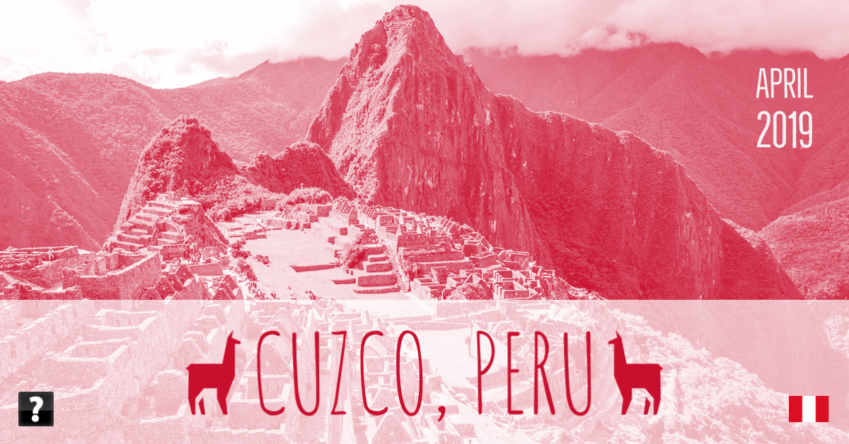
More than a year ago, in late April, and into early May 2019, my mother, my youngest sister and I went on a bucket list trip: to see Machu Picchu [wikipedia.org].
Machu Picchu is one of those places that has been in the “oh my god I have to go” since I was a kid. We watched a lot of National Geographic specials when I was young (back in the pre-cable days when we had four channels: ABC, NBC, CBS and PBS.) I’m sure I first came across Machu Picchu on one of those specials. The many shows on the story of Hiram Bingham‘s [wikipedia.org] expeditions and the mysteries of Machu Picchu as well as the possible connection to the Indiana Jones movies, all of which were favorites in my house growing up, added to the mystic of Machu Picchu putting it near the top of my must-see-in-my-lifetime list. While I’ve checked off a lot of places on that list between my life in the US, my time in Europe and living in Asia, Machu Picchu was my first Central or South American site.
I flew via Amsterdam, 31 hours in total to get to Lima. I met my mom and sister in the airport there and took a short flight to Cuzco. The landing in Cuzco was an experience, because of the mountains all around Cuzco the plane makes a sharp banked turn and drops rapidly down to the runway. It’s a bit of a roller coaster.

We met a representative from our tour company at the airport and they dropped us at our Hotel, right in the center of Cuzco city. We spending the remainder of the first day walking around just to get somewhat acclimatised to life at 3000 meters above sea level. At that altitude climbing the steps up one level to our hotel room had the same effect as jogging a 100 meters or so. We had to work for the coffee we had at a second story café in the main city square, Plaza de Armas del Cuzco.
We started our site seeing on the second day, touring some of the main sites in and around Cuzco. We started just opposite our hotel at the Convent of Santo Domingo [wikipedia.org] which is built on the ruins of the Inca Coricancha or “the golden temple”, possible their most important temple. Much of the colonial architecture of Cuzco is built right on top of Incan and pre-Inca buildings, incorporating the large stones with no mortar in their foundations.
We took a car up into the hills around Cuzco to see some of the more Inca sites: Sacsayhuamán [wikipedia.org], Tambomachay [wikipedia.org] Puka Pukara [wikipedia.org] and Qenko [wikipedia.org]. All cool sites and considering Tambomachay and Puka Pukara are located at 3600 meters above sea level a good warm up for hiking at altitude. We returned to Cuzco in the afternoon and toured the Cusco Cathedral [wikipedia.org] where of course you can’t take photos of the amazing interiors…

The second day we explored the Sacred Valley on our way towards Machu Picchu. We saw the salt ponds at Maras [wikipedia.org], which were very cool. Our guide said there were over five thousand salt ponds but I’m sure he meant five hundred. Still it’s an impressive site, in use for salt production for hundreds of years before the Inca.
Nearby the Maras salt ponds we visited the Inca ruins of Moray [wikipedia.org]. This was one of the coolest ruins we saw, they look like some sort of arena or man made craters in the earth. A series of concentric terraces built into a couple of large natural depressions. As explained by the guide, the best guess is it was made to create a “microclimate” to better grow specific crops at higher altitudes than they would normally grow.
We finished the second day at Ollantaytambo [wikipedia.org] which competes with Puka Pukara for the best name of the ruins we saw (Machu Picchu is too well known). The ruins of Ollantaytambo are a series of massive terraces going up the side of the mountain known as the Terraces of Pumatallis, a large temple complex including the “Wall of the Six Monoliths” which is made up of six Stonehenge sized blocks, and several Inca storehouses.
The next day we left Ollantaytambo and made our way to Machu Picchu. We entered the city in the afternoon with clear skies and bright sunshine, and met our local guide who took us around for a few hours as the sun went down. Our guide was great, explaining a lot and letting us indulge in our photography for as long as we wanted. And the ruins of Machu Picchu were amazing. The lowering sun casting shadows of the still standing walls of store houses and temples and residences across the grassy plazas. Sheer drops down to the Urubamba River which hourshoes around Machu Pichu.
While we explored the city we saw the requisite llamas, including a baby llama and my sister had an up close encounter with one hungry llama that tried to eat her camera lens when she was changing lenses. Llama spit, yummy. We also saw several viscacha, a type of rodent which looks something like a rabbit, but with a longer tail and short ears. They are quite cute running across the ruins.

One of the cooler things we learned from our guide is that while the jungle has been cleared from Machu Picchu, since Hiram Bingham first brought it to the attention of the outside world in 1911, no re-construction is done. There has been some rebuilding due to earthquakes over the years, but only if a stone can be identified as fallen since the Bingham’s expeditions using the photos from the expeditions, is it replaced.
Machu Picchu shuts to visitors at sunset, so after a few hours we made our way down to Machupicchu Pueblo or Aguas Calientes [wikipedia.org] the small town in the valley below the citadel. The town is full of tourist hotels and cafes and restaurants. Basically a clean showers, cold beer and hot food for people who hiked the Inca Trail. Also a steady stream of busses up and down the switchback road up to Machu Picchu.
We woke up very early the next morning to take one of the buses up to Machu Picchu to catch the sunrise. Alas, despite waking at 4AM and being on one of the first few busses we didn’t get to see the sunrise. It was cloudy. Low hanging clouds hugged the tops of all the mountains surrounding Machu Picchu. On the plus side we got to see Machu Picchu with clouds rolling through the city so we got both the sunny and cloudy experiences. We decided to spend our full day taking some of the hikes.

First we hiked several kilometers back along the Inca Trail towards Cuzco, several hundred meters up to the Sun Gate, Inti Punku. We got to trek through the cloud forest with clouds rolling up and down the slopes, we walked in and out of the fog. By the time we got to the Sun Gate there were some breaks in the clouds creating a dappled effect on the city below us.
After hiking back to the city we went around the other side of the summit of Machu Picchu to hike the shorter trail to the Inca Bridge [wikipedia.org]. This part of the Inca road system was more dramatic, with sheer drops down two or three hundred meters to the Urubamba River below —with no railing. The Inca were crazy, the Inca Bridge itself is a few planks of wood spanning a few meter gap in a section of the path which is just half a meter wide and running along a vertical rock face.
That night we took the train back to Ollantaytambo and then a car back to Cuzco arriving quite late. The next day was May day so we just chilled in the city and explored some of the sites. Unfortunately the market we wanted to see was not so busy. We did walk around the San Blas neighborhood but many shops were closed for the holiday. So we just had a lazy day, which was just a well as we had booked an adventure for the next day with a 2 AM pick up.

Our last adventure started pre-sunrise as we caught a bus to drive 4 hours southeast of Cuzco to hike Vinicunca [wikipedia.org], the Rainbow Mountain or Mountain of Seven Colours. A couple of hours on the bus and we stopped for breakfast at a small lodge off the highway. After breakfast we got back on the bus and started to climb up one lane gravel roads. We started about 3,700 m.a.s.l. meters above sea level and over the next hour we climbed a thousand meters up these gravel roads hugging the rising mountains. When we stopped at the parking lot we were 4,700 m.a.s.l. at which point some people are already experiencing altitude sickness to the point of vomiting. Luckily no one in our group was vomiting.
From the parking lot it’s a 5 kilometer hike up to the summit of Vinicunca —which is actually a pass, the lowest point around to cross over the Andes in this region. The foot of the pass is 5,000 m.a.s.l. and then it’s another 36 meters to the very top of Vinicunca. The first part of the hike is a relatively gentle rise, it takes most of the first 4 kilometers to go up, maybe 230 of the 336 meter elevation change. Even though the lack of oxygen means that even this shallow rise makes you out of breath if you go too fast. Everyone goes at different speeds depending on their fitness and age and our guide, who does this every day, went back and forth making sure everyone was ok. I’m not sure if he needed to use it but he carried an oxygen bottle just in case.
My mother, sister and I went at a slow pace and didn’t have much issues with the first 4 kilometers. The last kilometer was much steeper and we were stopping to catch our breath and let our muscles re-oxygenate regularly. At first we were stopping every 100 meters, then every 50 and soon every 10. By the time we got to the last 100 meters we were playing the “10 more steps to that rock and then we will rest” game. And the last 40 meters is a dirt stairway. By the time we got to the top we were going one. step. at. a. time. But we made it to the 5,000 m.a.s.l.. And I did make it all the way to 5,036. An Amazing view, with the colours of Vinicunca on one side, the red valley spread out before you and snowcapped Ausangate wrapped around behind you. (I wrote about this in brief before.) [confusion.cc]

And that’s about it. We had one more morning in Cuzco for some shopping and then started our return. Flying to Lima and waiting hours for our next flight, where we had to stand in the ticketing lobby for a few hours as they only open the desk three hours before the flight and we had about 6 hours between the flights from Cuzco and our international flights. I came back the way I went, 22 hours via Amsterdam to Singapore, not including the 4 hour stopover in Amsterdam or the 6 hours in Lima. But it was worth it to knock Machu Picchu off the bucket list.
As a last note: it’s always hard to title these travel posts… I started using the city or region and then country and then the month and year long ago. For the most part that has served me well, but there are a few holes in the logic. For example, a trip to multiple major cities or countries — say a trip to Amsterdam with a short side trip to somewhere in Denmark. Do I make two posts? Or keep it as one under “Amsterdam, Denmark…”? I’ve split this type of trip up most times, but that means sometime ending up with a set of photos and a post that are quite small. On this trip I chose Cuzco which is both the city we started in, though we spend nights in two others places, and also the name of the administrative region of Peru that almost everything we went to see was in. So should it be “Cuzco, Cuzco, Peru…” or “Cuzco Administrative Region, Peru…”. Anyway, it’s a minor thing. It’s also a good problem to have, a first world and privilege problem given the cost of this type of travel. So, I’m lucky to have to try and figure it out.
You can see the whole Cuzco, Peru, April 2019 photoset on Flickr [flickr.com].